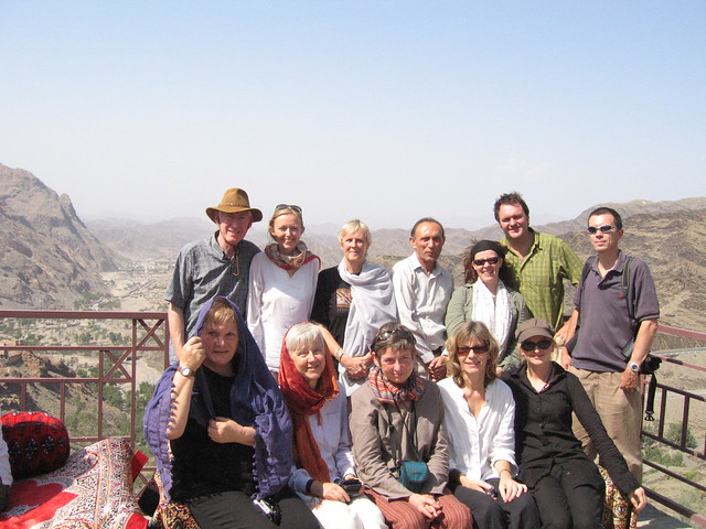
The Hindukush Adventurers: Standing (L to R) Rob, Mary, Ann, Zafar, Ali, Stanley, Benedict, Sitting (L to R) Patricia, Thelma, Joan, Annie, Amanda
I have already shared three Photo Travelogue of Mary Loosemore in Jaho Jalal, which includes the travel of the Mary's Hindukush expedition from Peshawar to Ayun over Lowari Pass, Ayun to Kalash Valley and Kalash Valley to Chitral. In that context, this post is the fourth Photo Travelogue that covers the travel of the Hindukush expedition from Chitral to Gilgit through the famous Shandur Pass.
I may add here that I am sharing Mary's travelogue of Hindu Kush mountain range after seeking exclusive permission from Mary Loosemore.
I may add here that I am sharing Mary's travelogue of Hindu Kush mountain range after seeking exclusive permission from Mary Loosemore.
Here is how my last post 'Chitral - the land of Tirich Mir' ended:
After Chitral, the group ventured north and north east towards Shandur Pass and onward to Gilgit, the capital of Gilgit-Baltistan. The journey onward is through spectacular scenery, awesome overlooking mountains and lakes with reflections of snow covered peaks. The journey onward will be covered in my next post.

So here we go as the team leaves the comforts of Chitral and wanders along the scenic Hindukush range to Gilgit. The route from Chitral to Gilgit passes through Booni, Mastooj, Shandur Pass, Khonan Deh and Gilgit. The map above may be opened separately to know the details as I had to join 3-4 screen clips to make it one.
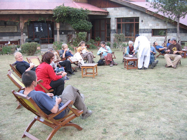
The group at the Hindukush Heights motel - resting for the day and being served tea upon arrival

So here we go as the team leaves the comforts of Chitral and wanders along the scenic Hindukush range to Gilgit. The route from Chitral to Gilgit passes through Booni, Mastooj, Shandur Pass, Khonan Deh and Gilgit. The map above may be opened separately to know the details as I had to join 3-4 screen clips to make it one.
The group at the Hindukush Heights motel - resting for the day and being served tea upon arrival
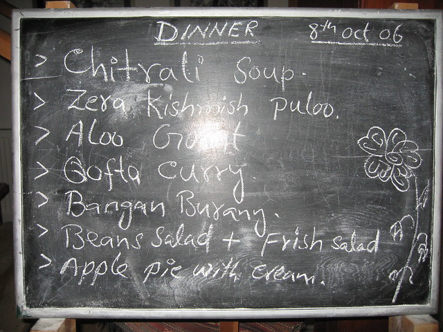
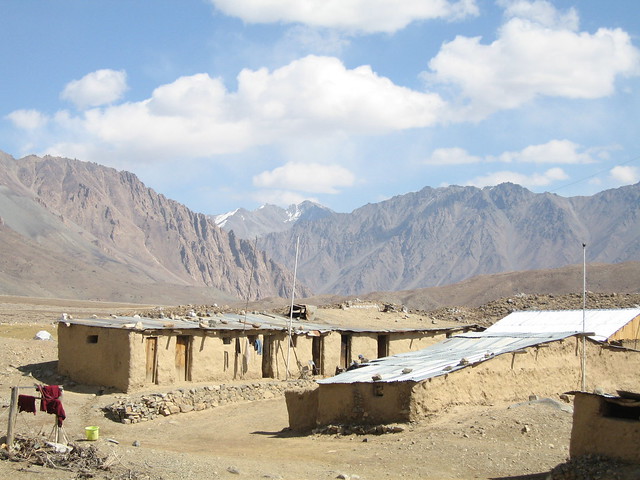
On Day-11 of their travel, i.e. 8th of October 2006, the group left Chitral and headed towards Booni and had a night stay at the Hindukush Heights motel as seen above. The menu for the dinner included some local delicacies which were devoured with great delight by Mary's group. Here is what the menu for the dinner was:
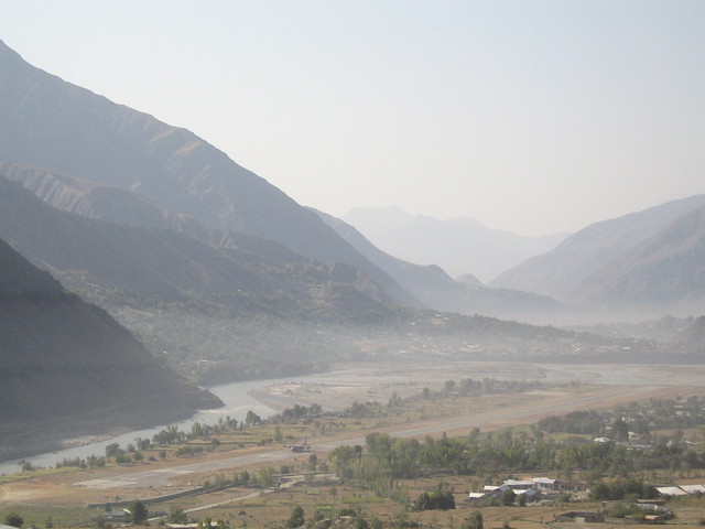
Looking back: the early morning view of the Chitral Valley from the Hindukush Heights motel
Travelling up to Mastuj, with Buni Zom (6,651 M) on the right
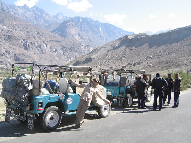
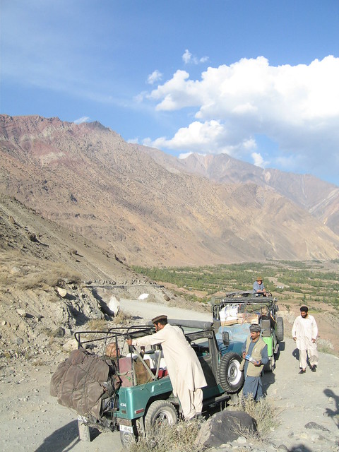 Jeeps and drivers, at the Buni Zom look out point
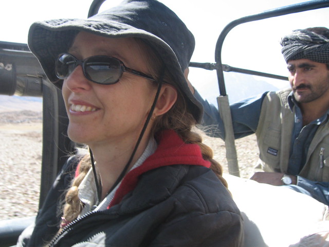
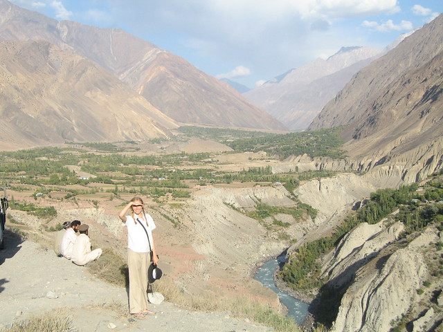 Mary posing on the track to Mastuj
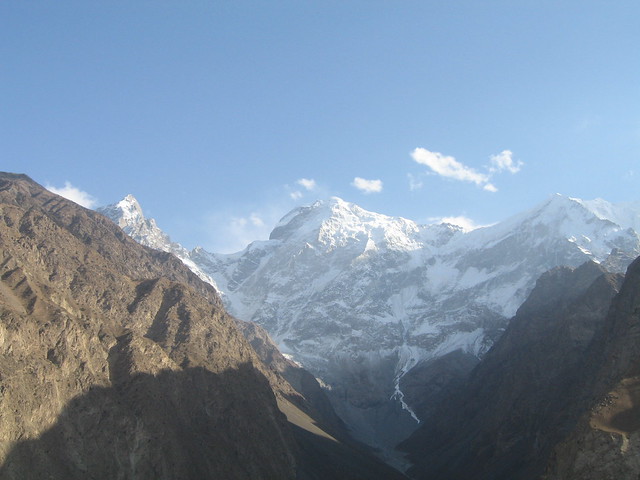
Spectacular Buni Zom Group of Mountains
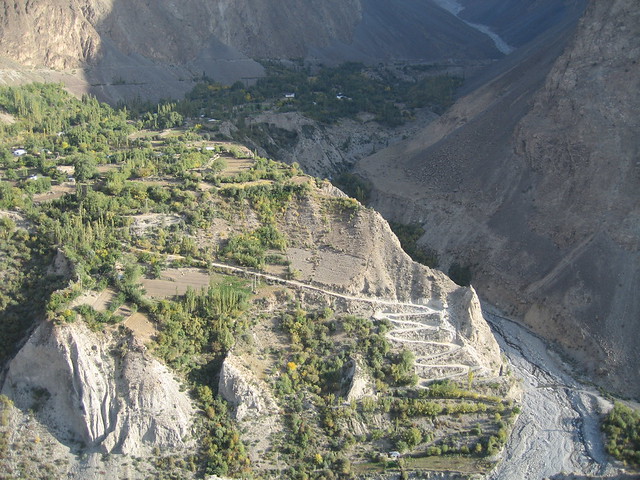
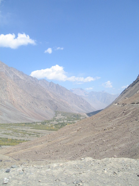
Village at the foothills of Buni Zom, with jeep-able dirt track going down to Mastuj River
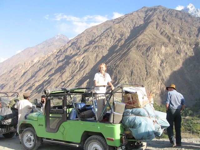
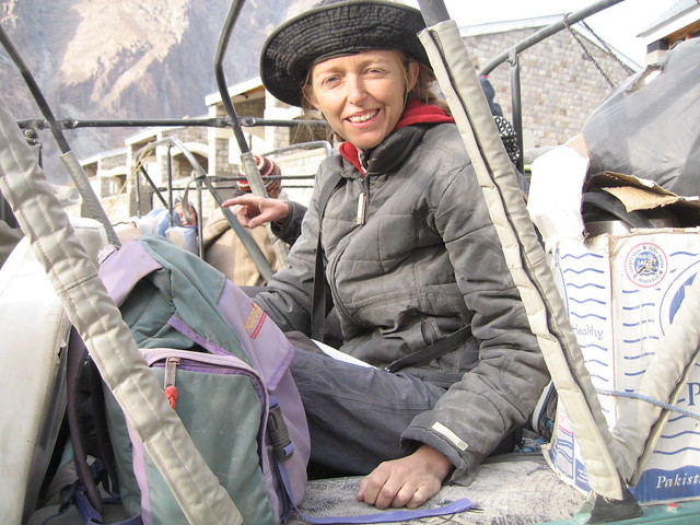
Mary on the Jeep at a rest point
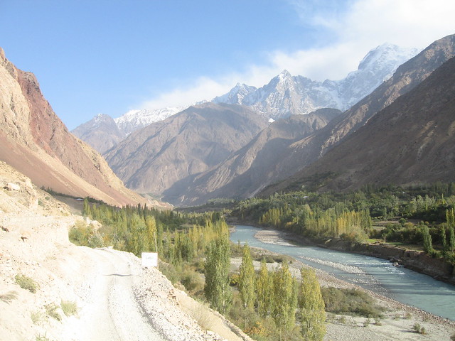
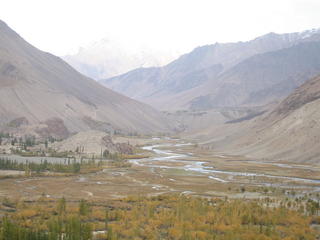
The spectacular Mastuj Valley lit up by the afternoon sun
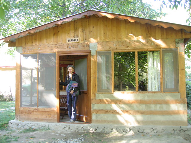
Mary at the Mastuj 'branch' of the Hindukush Heights Motel
-->
The dinner included Chitrali Soup, Zera-Kishmish Pulao (Rice Pulao with cumin seeds and raisins), Aloo Gosht (Meat and Potato curry), Qofta Curry (meatballs curry), Bangan Burany ( a dish of eggplants), and of course Beans salad and Fresh Salad. The last one is my favourite: Apple Pie with cream.
Looking back: the early morning view of the Chitral Valley from the Hindukush Heights motel
After a day's rest at the Hindu Kush Heights, the adventurers headed towards Mastuj.
Travelling up to Mastuj, with Buni Zom (6,651 M) on the right
The Buni Zom is a group mountains about 50 kilometers northeast of Chitral town, and some 50 kilometers east of the mighty Tirich Mir.
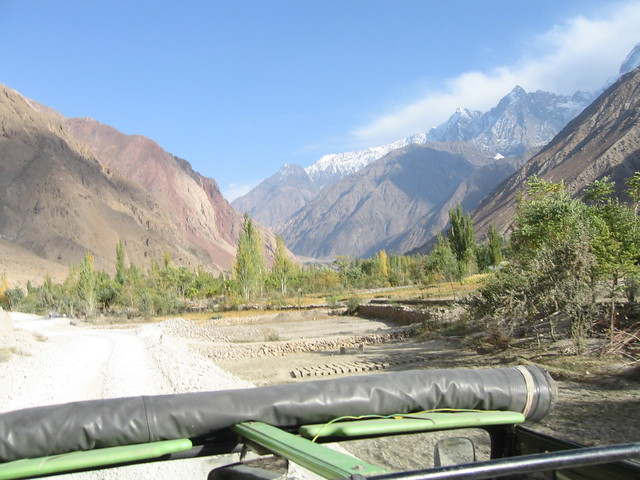
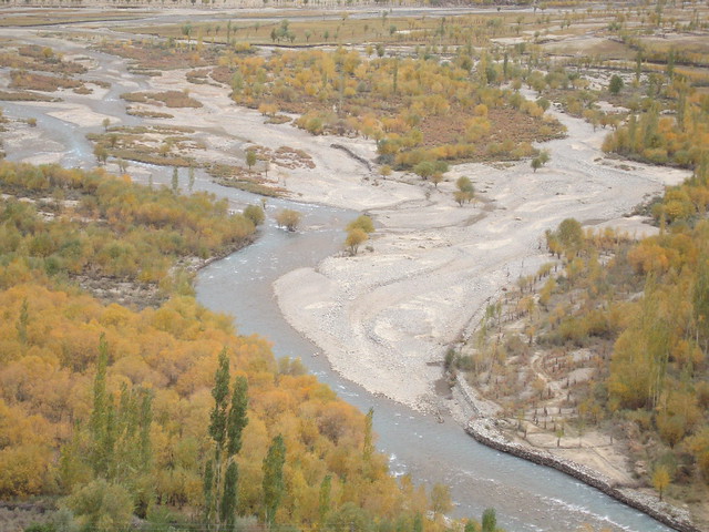
Traveling along the Mastuj River on the dirt mountain track
From the Buni Zom Look Out Point, as seen above, Mary's group could look back along the Mastuj river towards Chitral and Tirich Mir, across the river loomed Buni Zom, and ahead lay the road and the river to Mastuj and the Shandur
Spectacular Buni Zom Group of Mountains
Buni Zom group of mountains consists of 29 peaks, with highest rising to an altitude of 6,651 Meters. You may read about details of the Buni Zom group of mountains at Wikipedia from the link given at the end of the post.
Village at the foothills of Buni Zom, with jeep-able dirt track going down to Mastuj River
Mary on the Jeep at a rest point
The spectacular Mastuj Valley lit up by the afternoon sun
Mary at the Mastuj 'branch' of the Hindukush Heights Motel
Mastuj is a peaceful, quiet and scenic town in upper Chitral. The town is considered to be the gateway to Shandur and Boroghil Passes. The extremely cold weather makes it conducive for walnuts, apples and grapes.
One of the landmarks of Mastuj is the remains of the Mastuj Fort which was built some 300 years ago. Before independence of Pakistan, it was the seat of the local Kushwaqt tribe which spread from northern Chitral to the territories of Ghizr and Yasin in Gilgit.
Not much is left of the old fort except its seven-feet thick walls of stone put together with wooden struts and plastered with mud. The six watch towers and the two dungeons have all fallen prey to a series of earthquakes.
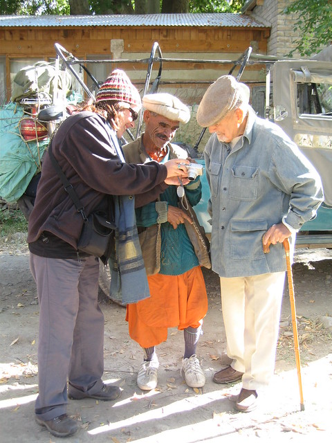
Colonel Khushwaqt ul Mulk and his trainer being shown photos on digital camera by Ali
At Mastuj, the group was guests of Colonel Khushwaqt ul Mulk - an avid horse rider and son of the soil. The group had the honour of being his guests, who is still considered to be a legend.
However, four years later, the Colonel died on 12 February 2010 at the age of 96. At the time of his death, he was the senior most living officer of Pakistan Army. In fact he had received a letter from his old school in Dehra Dun, India stating that “after the demise of Gen. Dubey six month ago you are now the senior most living officer to be commissioned from the Indian Army”. He was laid to rest in Mastuj, Chitral district on February 13, 2010. He was a sportsman, a philanthropist, a social activist and a prominent figure of the country.
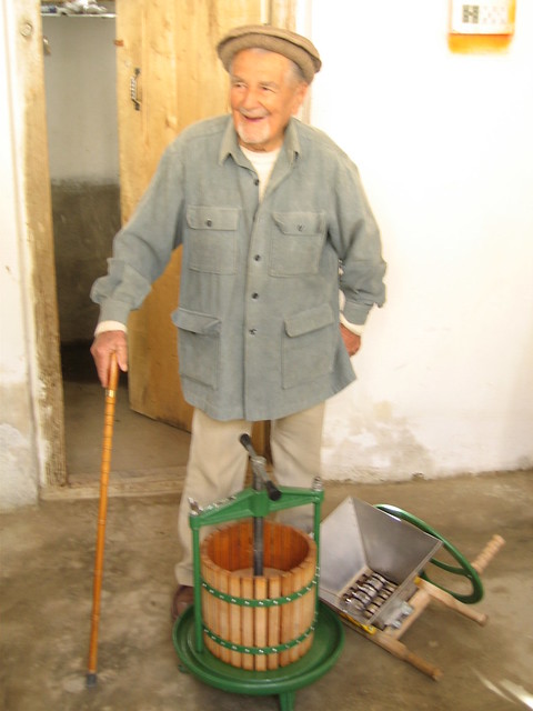
The Colonel showing his apple press
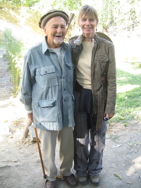
Colonel with Anie
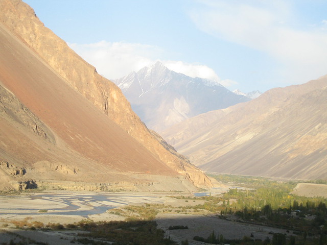
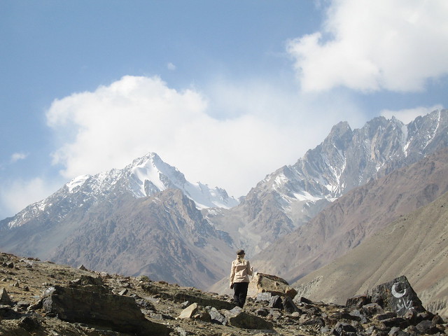
Looking back along the Laspur valley towards Mastuj
After a tour of the Colonel's distillery, the group left Mastuj, taking the jeep track along the Laspur Gol towards the Shandur Pass.
Colonel with Anie
Looking back along the Laspur valley towards Mastuj
The mountains ahead on way to Laspur Gol
The Shandur Pass, 12,250 Feet
The Shandur Pass, 12,250 Feet
Located at a height of 12, 250 feet, the Shandur Pass is situated midway between Chitral and Gilgit. In winter the Pass is blanketed by heavy snow, which melts during summer making it a lush green place. Shandur Lake with its serene waters is on the top of the Pass that can be reached by jeep from either side.
Shandur is famous for its annual Shandur Polo Tournament, which is generally held in the second week of July from 7-9 July. Since the initiation of the tournament, only two traditional teams from Chitral and Gilgit participate in the tournament.
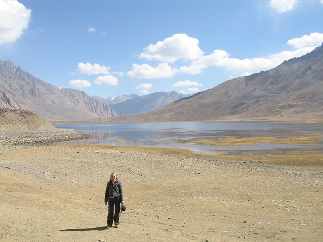
Mary at the Shandur Pass
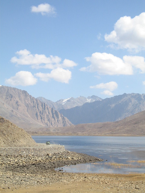
Shandur Pass and the dirt track with the expedition's jeep visible
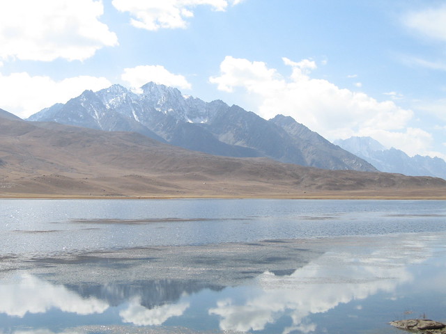
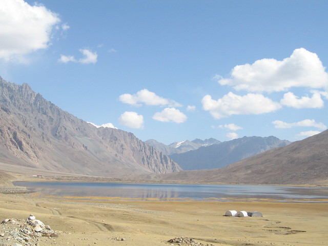
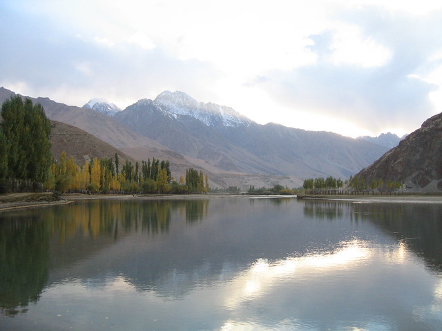
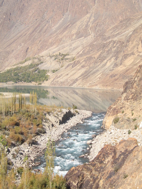
Mountains' reflections in the lake at the top of the Shandur Pass
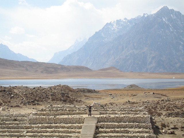
Mary at the footsteps of Shandur Polo Ground with the lake in the background
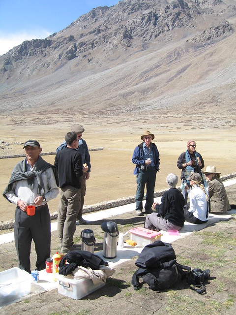
Tea Break at the Shandur Polo Ground
Hutments at Shandur
Mary at Shandur
Heading along the Gilgit river towards Phander
Shandur Pass and the dirt track with the expedition's jeep visible
Mountains' reflections in the lake at the top of the Shandur Pass
Mary at the footsteps of Shandur Polo Ground with the lake in the background
Tea Break at the Shandur Polo Ground
Hutments at Shandur
Mary at Shandur
Heading along the Gilgit river towards Phander
After a picnic at the watershed of the Shandur-Hundrup National Park, the group started theirdescent from the Shandur Pass - the literal high point of the trip - heading along the Gilgit river towards Phander. Once over the Pass, the group entered Gilgit District crossing out of the North West Frontier Province and into the Northern Areas, now called the Gilgit Baltistan Province.
Autumn colours along the Gilgit River

Gilgit Valley view - driving towards Phander
Arrival at the PTDC motel at Phander
Gilgit River, Phander
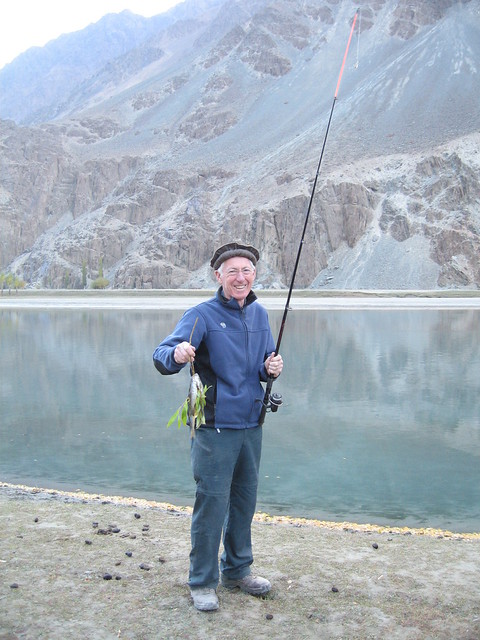
Rob and "his" haul ot trout from the Gilgit river, Phander
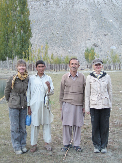
The real fisherman, with Annie and Amanda
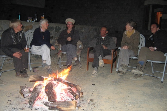
Camp Fire at Phander: Ann, Thelma, Ali, Zafar, Annie, Benedict
Gilgit Valley view - driving towards Phander
Arrival at the PTDC motel at Phander
Phander is a small town located in the Ghizer Valley of Gilgit Baltistan The town is located at a distance of two hours drive from the Shandur Pass at a height of 3,743 M. The town is famous for its trout-filled waters and lush green fresh serene environs.
Gilgit River, Phander
Rob and "his" haul ot trout from the Gilgit river, Phander
The real fisherman, with Annie and Amanda
Camp Fire at Phander: Ann, Thelma, Ali, Zafar, Annie, Benedict
The night stay at Phander PTDC motel was a night to remember. The group raised a (small) glass of sloe gin and toasted the health, wealth and happiness of Mufti, Deman and Sawa - our lovely Chitrali jeep drivers.
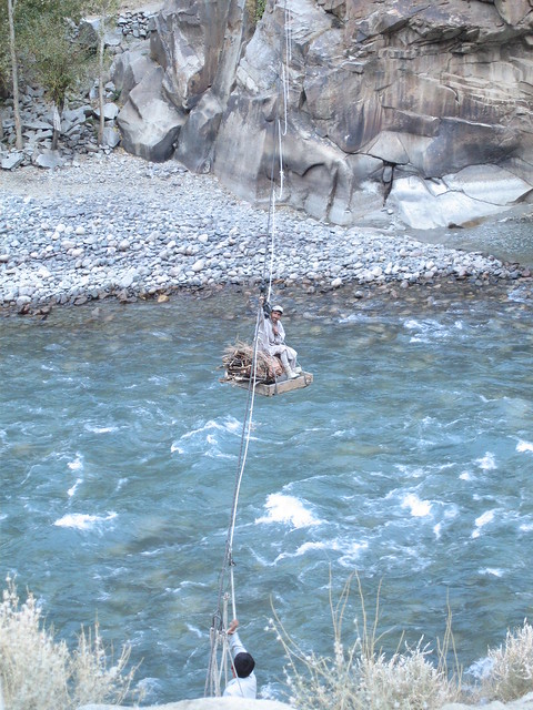
Crossing Gilgit River and all water channels in the area is hair raising and dangerous - but that is how life goes on here
Bridge over Gilgit River: Panoramic View
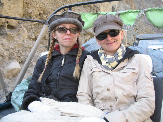
"The correct form of address is 'Ma'am'", say the ladies, Mary and Amanda
Gilgit River - the purse turquoise blue water
Legs stretch time en route to Gilgit
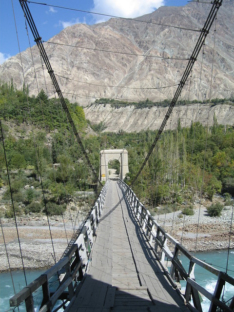
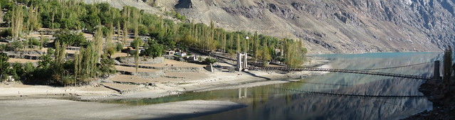
Suspension bridge over Gilgit River
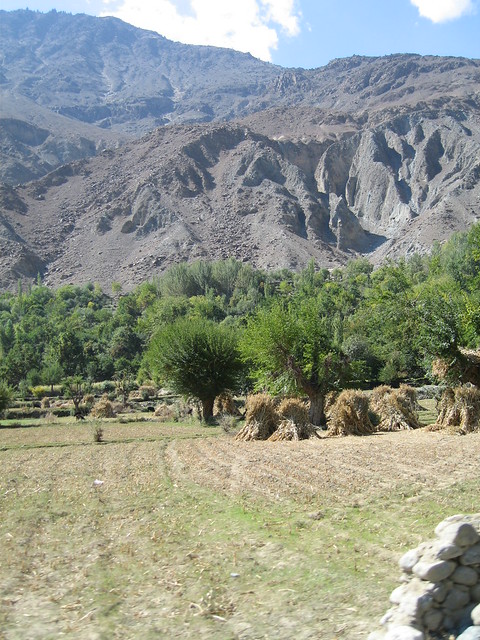
Fertile farmlands, orchards and the harvest - approaching Gilgit
Bridge over Gilgit River: Panoramic View
"The correct form of address is 'Ma'am'", say the ladies, Mary and Amanda
Gilgit River - the purse turquoise blue water
Legs stretch time en route to Gilgit
Suspension bridge over Gilgit River
Fertile farmlands, orchards and the harvest - approaching Gilgit
Having reached Gilgit, the Hindukush Range comes to an end. From now on, it is travel in the Karakoram to wards Hunza and the Baltit Fort and back to Islamabad on the Karakoram Highway, the KKH.
I will cover the remaining part of the journey in my next post.
Previous Photo Travelogues of Mary Loosemore at Jaho Jalal:
Read more about:
Buni Zom (Wikipedia)
Colonel Khuswaqt ul Mulk: | The Telegraph | Chitral News |
Ghizer District (Wikipedia)
Gilgit (Pakistanpaedia)
Gilgit Baltistan Province (Pakistanpaedia)
Colonel Khuswaqt ul Mulk: | The Telegraph | Chitral News |
Ghizer District (Wikipedia)
Gilgit (Pakistanpaedia)
Gilgit Baltistan Province (Pakistanpaedia)


5 comments:
A beautiful Pictorial with scenic views article. No doubt our Northern areas are enriched with such places but unfortunately i the absence of Tourism Industry, these are hidden from the world. The Tourists coming to these areas are recommended by their fellow citizens,who have visited earlier.
Thanks Jalal for sharing.
i apreciate your great efforts...when i see and read all this I love my Pakistn alot more....long ive Pakistan
i apreciate your great efforts...when i see and read all this I love my Pakistn alot more....long ive Pakistan
I couldn't resist commenting. Very well written!
Here is my webpage - Learn how to academy online
I'm really enjoying the theme/design of your site. Do you ever run into any web browser compatibility issues?
A number of my blog audience have complained about my site not operating correctly in Explorer but
looks great in Opera. Do you have any recommendations to help fix this issue?
Take a look at my site; Cambogia premium
Post a Comment